
|
Living With the Methow River Monthly Activities and Learning Opportunities June 2014
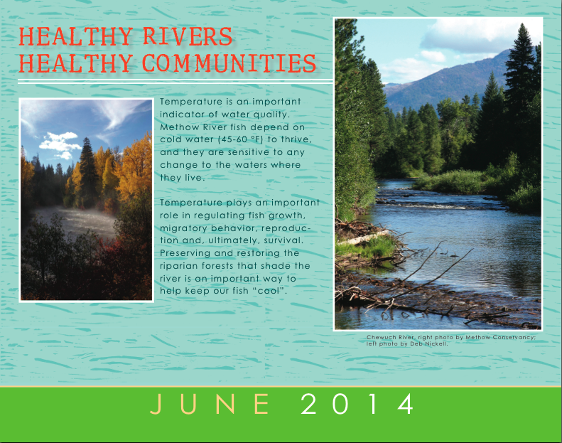
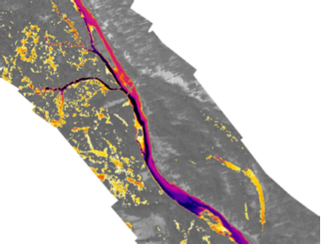
Healthy Rivers – Healthy Communities – Healthy Fish! Most of the fish that inhabit the Methow River watershed depend on cold water for their survival. When streams become too warm, these fish die, grow slowly, or are forced to move elsewhere. Streamside trees, shrubs, and ground cover, known collectively as riparian vegetation, help to maintain cold water in streams. As anyone who has sought the refuge of a shade tree on a hot summer’s day can attest, the shade provided by the vegetation blocks some of the heat that would otherwise warm the water. Intact and diverse riparian forests are a key component of a healthy watershed. Riparian forests also provide habitat for an amazing diversity of plants and animals. Riparian vegetation is often lost due to natural causes such as forest fires and landslides. Human causes include direct clearing of vegetation for farming, improving views, development, and modifications to the streambanks for flood control. Whatever the cause, removal of riparian vegetation reduces shade and warms the river. Water temperatures in the Methow River exceed Washington State water quality criteria, making the Methow an impaired water body under the Clean Water Act. Our strategy for habitat restoration includes replanting these crucial species to restore their cooling effect on the watershed. The Methow Restoration Council is working with a diverse group of landowners to restore riparian vegetation throughout the watershed. One way to identify and monitor water temperatures is through infrared photography. Infrared sensors attached to aircraft pick up surface water temperatures while the aircraft flies above a stream. The US Geological Survey and US Bureau of Reclamation fly the river periodically, and through our partnership with them, we gain access to their maps of the river’s temperatures from the headwaters to the confluence. This information helps us prioritize future work, monitor the effectiveness of past work, and estimate the health of the river ecosystem.
The Upper Methow, as seen in infrared. Darker color indicates cooler water temperature.
This year’s MRC calendar connects to ADVENTURES, ACTIVITIES AND INFORMATION tailored to each month. If you haven't gotten your calendar yet, you can download an electronic version here. Come back each month and find interactive activities, print outs, and suggested learning opportunities in our community.
Just follow the fish and engage in learning.
Previous Learning Opportunities: |